
I’ve been trying o1 preview for a few weeks.
Wowza what a clownshow. Can I please just have 3.5 without guardrails?
“The future ain’t what it used to be.”
-Yogi Berra


I’ve been trying o1 preview for a few weeks.
Wowza what a clownshow. Can I please just have 3.5 without guardrails?


Turns out land is still cheap and sunlight still generally free.


What we’re experiencing right now is basically the impact of around 1.5 degrees. All of that is basically from very old emissions. We’re on the hook for at least a couple more degrees, but its not like we’ve even slowed or stopped the rate of emissions, so perhaps even more than that.
The impacts of these forcings won’t be linear.


Oh no. Anyways.
tits out for harambe
“It’s crucial…”


new. no filters. it’s like drinking from a garden hose.


Israel has left the path of the moral high ground wide open.


I’ve done several AI/ ML projects at nation/ state/ landscape scale. I work mostly on issues that can be solved or at least, goals that can be worked towards using computer vision questions, but I also do all kinds of other ml stuff.
So one example is a project I did for this group: https://www.swfwmd.state.fl.us/resources/data-maps
Southwest Florida water management district (aka “Swiftmud”). They had been doing manual updates to a land-cover/ land use map, and wanted something more consistent, automated, and faster. Several thousands of square miles under their management, and they needed annual updates regarding how land was being used/ what cover type or condition it was in. I developed a hybrid approach using random forest, super-pixels, and UNET’s to look for regions of likely change, and then to try and identify the “to” and “from” classes of change. I’m pretty sure my data products and methods are still in use largely as I developed them. I built those out right on the back of UNET’s becoming the backbone of modern image analysis (think early 2016), which is why we still had some RF in there (dating myself).
Another project I did was for State of California. I developed both the computer vision and statistical approaches for estimating outdoor water use for almost all residential properties in the state. These numbers I think are still in-use today (in-fact I know they are), and haven’t been updated since I developed them. That project was at a 1sq foot pixel resolution and was just about wall-to-wall mapping for the entire state, effectively putting down an estimate for every single scrap of turf grass in the state, and if California was going to allocate water budget for you or not. So if you got a nasty-gram from the water company about irrigation, my bad.
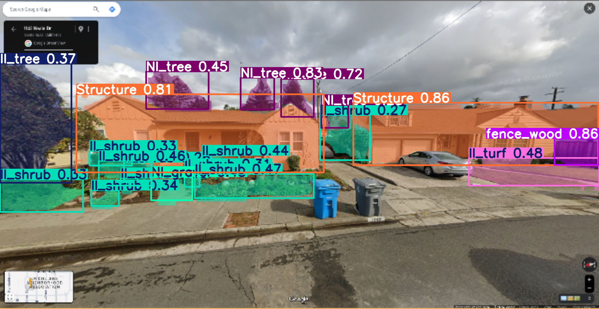
These days I work on a small team focused on identifying features relevant for wildfire risk. I’m trying to see if I can put together a short video of what I’m working on right now as i post this.
Example, fresh of the presses for some random house in California:


Imagine buying a policitian’s cryptocurrency


Click on all busses:


There is a short story in here about someone who can’t pass a captcha, loses their identity, and has to move on to becoming a fisherman in Norway.


Dude I can’t even pass a catchpa these day. I still don’t know if a e-bike is a scooter, a bike, or a moped.


Is that a threat to pull the leash?


At a certain point you gotta stop voting for the ‘good cop’ part of the ratchet effect.


Hey real leadership


I didn’t have an issue reading small text on the Deck.
I will say that I found the experience of playing Witcher on the deck to be an absolute pleasure.


Yeah I think I tried like 4 controller layouts on the steam deck before settling on one.


Be, um, …
selectiveseductive
ftfy.
Super game.
and keybroad